© Emilie Coudel
Adapting to climate change on the Amazonian floodplains
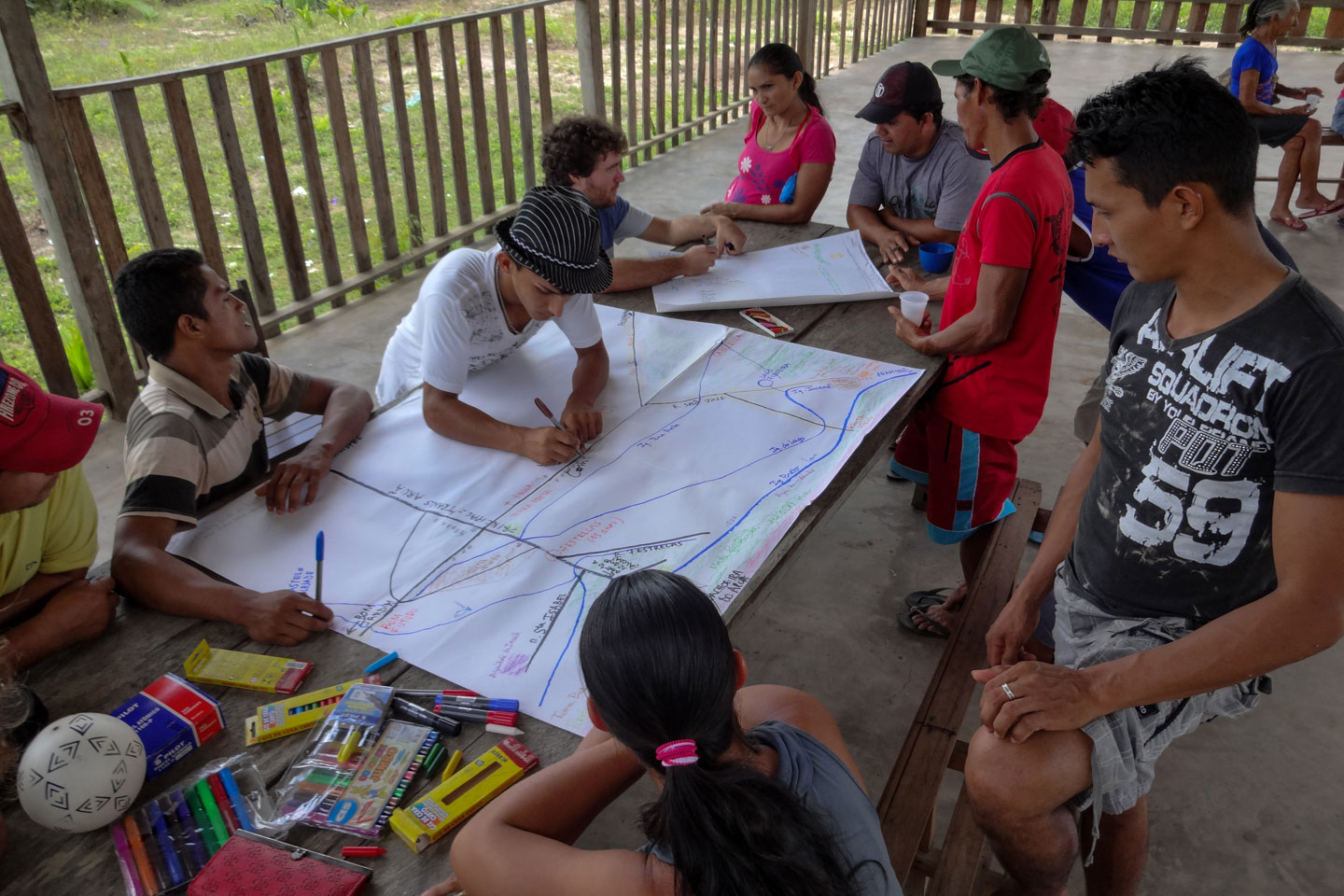
The floodplains in Amazonia are low, flat lands lying alongside the rivers that undergo periodic flooding. Over the centuries, these have been privileged space for humans living in the biome. Traditional populations gathered here, where they lived from fishing, hunting and forest products.
This system began to face crises in the 1960s when national development plans for Amazonia brought another type of people to the region to settle vast, inexpensive tracts of land, mostly from southern Brazil. This new socioeconomic scenario marginalized more sustainable forms of development. The rural communities that remained have had to fight for their survival in degraded ecosystems where the traditional seasonal cycles have changed because of more frequent flooding and extreme drought.
THE TERRITORY
In western Pará State where the Amazon and Tapajós rivers join near the Lago Grande do Curuai, lies an extensive flood plain that encompasses three municipalities and was selected for the Territorial Accompaniment project. This region has a longstanding tradition of sustainable fishing, hunting and forest products which has been placed at risk by the advance of cattle raising and the impact of climate change.
The project was carried out in partnership with local organizations like FEAGLE—the Federation of Citizens and Community Associations of the Gleba Lago Grande Agro-extractivism Settlement, the Santarém Family Farmers and Rural Workers Union, and CFR—the Rural Family House Community School. It was designed with the following objectives: to build a dialogue with the riverbank communities, to understand the factors placing pressure on the communities’ activities, to create and evaluate strategies for adapting to climate change, to improve the living conditions of the local population, and to protect the environment.
THE ACTIONS
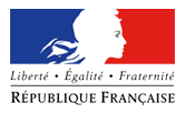
Teachers and students from the Rural Family House held a fundamental role in the process of knowledge co-creation inside the communities, which underwent a number of stages and activities. These included debates and sharing of knowledge, studies on the main changes (social, economic and environmental) that have occurred on the floodplains over the years, mapping of the different uses of the territory and the practices in use, organization of a calendar of fishing and cattle raising activities in the region, a study of the main challenges for sustainable development and the definition of a shared vision for the future of the territory.
© Emilie Coudel
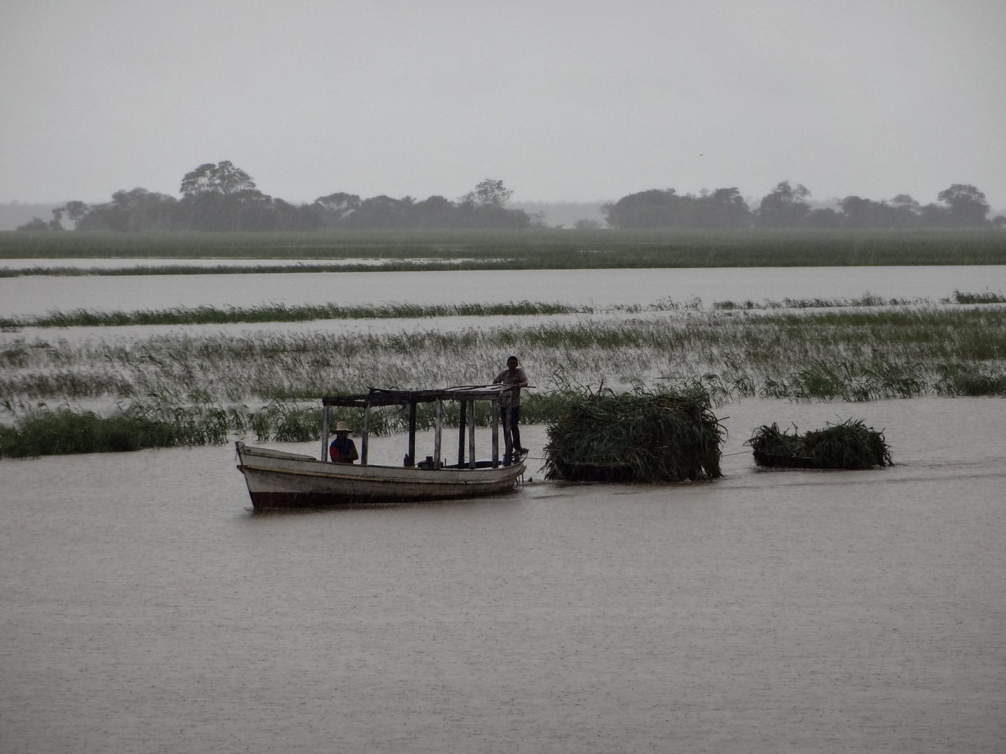
BUILDING KNOWLEDGE
Territorial Accompaniment led to the identification of four sectors with distinct socio-economic dynamics:
Floodplain communities: communities in which activities are intimately related to the rhythm of the river’s flooding and drought. These floodplains are used for farming or cattle raising and are affected by environmental changes, which leads to tension between the two models of use. Obstacles to maintaining crops and cattle herds on the plains have led stakeholders to seek other spaces farther inland, near to villages and on black soil. This has resulted in deforestation and generated conflicts with the people who live there (over water sources, for example).
Lakeside communities: communities of fishermen and small cattle farmers. These have undergone socio-environmental changes brought on by construction of the Translago freeway, which cuts through the region and offers easier access to the cities of Santarém and Juruti. The freeway caused the population to grow, drew life away from the smaller towns, affected the rhythm of flood and drought, and reduced both the size of the fish themselves, and the fish populations. Fishing as a livelihood began to generate less income, farming became more difficult and cattle raising now requires that cattle be taken to distant locations to find pastureland.
© Emilie Coudel
Solid ground communities: These communities are located on the parts of the plains that don’t undergo flooding. Traditionally, they are agricultural communities composed of small farms. In recent decades, the territory has attracted cattle ranchers and new medium scale pastureland has been created (averaging 100 hectares in size). Because of this, agriculture has receded (the manioc flour production market has crashed), the environment is undergoing degradation (the presence of buffalo in the creeks has destroyed fish habitats), deforestation (in order to open pasture) and less extraction of forest products (because there is less forest).
Colonies: the colonies are regions of firm soil located inland, farther away from the rivers. Here, standing forest is still abundant, the soil is black, and Indigenous communities are expressively present. Small farms and use of forest products are important, and new agroforestry systems are beginning to flourish. The main risk is the arrival of timber companies, which has been happening over the last 10 years.
© Emilie Coudel
CREATING MODELS AND EXPLORING SCENARIOS
One methodology proved to be of particular importance in motivating stakeholders in the project: Companion Modeling (ComMod), which is based on co-development of games that simulate the local reality. Through these games, participants arrive at a shared viewpoint of the social and natural dynamics in a determined territory. Then, they explore different scenarios for the future. On the Lago Grande do Curuai floodplain, six students of the CFR participated in the creation of an interactive boardgame which was later tested by the entire student group and then taken into the communities. It was given the name Várzea Viva [Living Floodplain], and allowed participants to explore the viability of different resource use strategies and evaluate their consequences.
Based on a shared vision of the current situation (which was crystallized during the knowledge co-building phase), the players negotiate possible solutions, establish objectives for the future and create scenarios to reach them.
THE RESULTS
Because they placed stakeholders before simulated realities, the activities developed within the project helped participants to better understand the effects of their behavior on the real world. In debates held after each round of the game, participants reached relevant conclusions about the challenges faced on the floodplains:
-
- The current rate of flooding limits natural pastureland and forces cattle farmers to rent pasture or cut down forest on firm ground, resulting in excessive costs compared to the expected return.
- As the harvest cycle is limited due to the increasingly prolonged floods, manioc farming requires large plots of land and intensive labor. Returns are risky because they are tied to variations in manioc flour prices.
- Industrial fishing heavily impacts fish populations
- Human activity affects the water quality, especially in the case of cattle farming near to riverbanks. At the same time, the abandonment of flood zones due to more frequent flooding leads to higher population density in other areas, resulting in precarious sanitation conditions, which also affect water quality.
- Younger stakeholders especially feel the need to diversify productive activities, but run up against the obstacle of weakened local markets. These have been substituted by intermediaries who, because of the new freeway, have access to other markets and drive local prices down.
- The challenges on the floodplains are linked not only to climate change, but also to socioeconomic and demographic transformation.
PROJECTS
-
- ClimFabian (2012-2015), with funding from Fondation pour la Recherche pour la
- Bonds (2019-2022), with funding from Belmont Forum-Biodiversa
- Saberes (2020-2025), with funding from BNP Paribas
UNANSWERED QUESTIONS
The Territorial Accompaniment project on the Lago Grande do Curuai floodplain continues, with the objective of helping local stakeholders orient their decision making. Currently, the priority is fishing, an essential source of protein and income for the local people. This activity is being threatened by degradation of habitats and industrial fishing, which have depleted fish populations. The researchers are using a participative modeling methodology to co-build a management plan for fish resources and land use.
PARTNER INSTITUTIONS
FINANCING